Gold Hill Mine
Gold Hill Mine is located in the center of a geologic zone known as the Gold Hill Mining District and within the North Carolina village of Gold Hill. The Gold Hill district, in the southeastern portion of Rowan County, contains what was once one of the most significant gold and copper mining facilities in the state. Although gold was first discovered in this district prior to 1824, most of the mines were found between 1842 and 1844 and worked until 1915. Important mines in the Gold Hill district included the Gold Hill Mine, Barnhardt Shaft, Miller Shaft, Honeycutt Mine, Troutman Mine, Union Copper Mine, and Barringer Mine.
Gold production from the Gold Hill Mine through 1915 is estimated at $1.65 million. The Randolph Shaft is one of the deepest in the South, reaching 820 feet. The largest vein in this mine was also the Randolph vein, which varied in width from 2 to 15 feet. The upper levels of the mine were reported to be extremely rich in gold, with samples ranging from ½ ounce to almost 19 ounces per ton in gold and less than 1 percent copper. During the last period of operation in 1914-15, 7,250 tons of ore was milled with a recovery of 3,877 ounces of gold, 6 ounces of silver, and 23,112 pounds of copper. All of this came from Gold Hill Mine's north vein.
References:
Brent D. Glass, "King Midas and Old Rip: The Gold Hill Mining District of North Carolina" (Ph.D. diss., UNC-Chapel Hill, 1980).
Francis Baker Laney, The Gold Hill Mining District of North Carolina, North Carolina Geological and Economic Survey (1910).
Additional Resources:
Gold Hill Mining District, NC Historical Marker L-81: https://www.ncdcr.gov/about/history/division-historical-resources/nc-highway-historical-marker-program/Markers.aspx?ct=ddl&sp=search&k=Markers&sv=L-81%20-%20GOLD%20HILL%20MINING%20DISTRICT
Gold Hill Mining Operations Artifact, NCDCR Collections (photos in this collection show the Randolph and Whitney Mine): http://collections.ncdcr.gov/RediscoveryProficioPublicSearch/ShowItem.aspx?40838+
Gold Mining District Map, UNC, North Carolina Maps Collection: http://dc.lib.unc.edu/cdm4/item_viewer.php?CISOROOT=/ncmaps&CISOPTR=1375&CISOBOX=1&REC=7
North Carolina Geological Survey, Gold in North Carolina: http://www.geology.enr.state.nc.us/Gold%20brochure/Gold%20Brochure%2012222000.htm
Crayon, Porte. "North Carolina Illustrated IV: The Gold Region" Harper's New Monthly Magazine XV. No. 87. August 1857. p. 289-300. http://books.google.com/books?id=1ikZAAAAYAAJ&ots=Y6ABpUMrRK&dq=Harper's%20Magazine%20volume%2015%201857&pg=PA289#v=onepage&q&f=false (accessed August 29, 2012).
Image Credit:
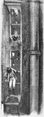
An engraving from Harper's New Monthly Magazine of August 1857 depicting miners descending the shaft at Gold Hill Mine. North Carolina Collection, University of North Carolina at Chapel Hill Library.
1 January 2006 | Freeman, Joan E.
